

Ah, spring has arrived! Thunderstorms, along with milder temperatures, are already encompassing most of the state this afternoon and are expected to continue through the weekend and into early next week. Then, of course, a cold front follows, bringing a couple of days of winter-like temperatures before finally recovering by the end of the week. But that is still a few days out, so we will now focus on the weather across Oklahoma for your Easter weekend.
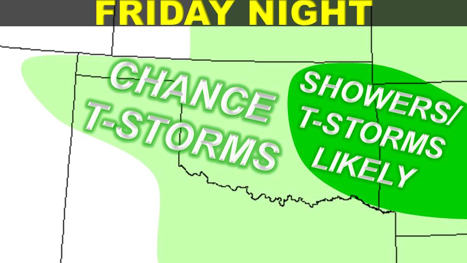
Friday Night

Saturday

 For Saturday, thunderstorms are likely all day in far eastern Oklahoma, indicated by the darker green shading on the map. In the rest of eastern Oklahoma and in central Oklahoma, expect a chance for showers and thunderstorms to occur before noon on Saturday. Then skies will remain partly to mostly cloudy for the remainder of the day. In far western Oklahoma, including the panhandle, partly cloudy skies will give way to cloudy skies and a chance for showers and thunderstorms in the afternoon. Please note that the Storm Prediction Center has initiated a slight risk for severe thunderstorms across all of the state except the northwest and panhandle for Saturday, so beware that any thunderstorms that do develop may be severe in nature. We encourage you to take caution. You can see the latest convective outlooks from the SPC by clicking HERE. Saturday’s high temperatures will soar as high as the low-80s in southwest Oklahoma. We will have the 70s elsewhere, but in far eastern Oklahoma, highs may only top out in the upper-60s. West-southwest winds will blow around 5 to 10 mph.
Saturday Night


 How does Easter Sunday shape up? In far southeastern Oklahoma, thunderstorms are likely throughout the day, indicated by the darker green shading on the map above. A 50% chance or less for thunderstorms exists for central and southern Oklahoma. In central Oklahoma, the chance for thunderstorms is only in the morning, while in southern Oklahoma the chance for thunderstorms lasts throughout the day. The north will enjoy mostly sunny to partly cloudy skies with no rain expected throughout the day. Highs will cool down a little but still be rather spring-like, with temperatures mostly in the 70s but perhaps only the upper-60s in areas of the west and southeast.
Looking past the weekend, Monday looks to bring a good chance for rain all across the state with cooler temperatures, quite cool in the panhandle. This will be the signal of a cold front, and Tuesday and Wednesday will be unseasonably cold, with highs in the 40s and 50s. By Thursday and Friday, the highs should recover to be more around normal.
Sources: NWS, HOOT, beauty-places.com (photo)
No comments:
Post a Comment