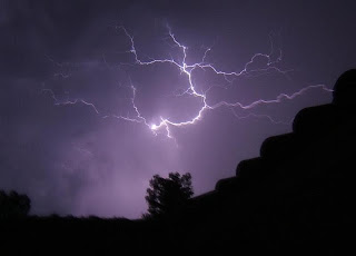
An upper-level low that moved from the Ohio Valley to the central Plains on Sunday and Monday is now situated over New Mexico. The low will move towards the south-southwest into Mexico by Thursday. The result will be continued scattered showers and thunderstorms across parts of the state, mainly the central and west, today. However, rain chances are not as high as yesterday. By Friday, all of the state should remain relatively dry. Come the weekend, we will see the return of isolated to scattered showers and thunderstorms across the state. Temperatures will be on a steady rise through the weekend and finally be back to normal or near normal by Friday.
Track the Rain
4-Day Rainfall Totals
Valid Saturday, July 13 12:00 PM CDT through Wednesday, July 17 12:00 PM CDT
ID
|
LOCATION
|
RAINFALL
|
BARTLESVILLE
|
0.24"
| |
CLINTON-SHERMAN
|
1.28"
| |
FREDERICK
|
3.03"
| |
GAGE
|
0.93"
| |
GUTHRIE
|
1.92"
| |
GUYMON
|
0.24"
| |
HOBART
|
1.74"
| |
LAWTON
|
1.46"
| |
MCALESTER
|
1.06"
| |
MUSKOGEE
|
1.21"
| |
OKLAHOMA CITY – WILEY POST
|
3.68"
| |
OKLAHOMA CITY – WILL ROGERS
|
4.35"
| |
PONCA CITY
|
1.44"
| |
STILLWATER
|
1.59"
| |
TULSA – RICHARD LLOYD JONES JR
|
0.53"
| |
TULSA INTERNATIONAL
|
0.44"
|
The Forecast
 For today, the best rain chances are in western Oklahoma and parts of central, mainly south-central, Oklahoma. Like yesterday, we are expecting storms to be more scattered in nature rather than a steady rainfall on Sunday and Monday. Storms will be even more isolated across north central and eastern Oklahoma, with chances of only about 20%. The sun is finally peaking out from behind the clouds for the first time in a few days across parts of the state. We'll have partly to mostly cloudy skies this afternoon. Highs will begin to warm up to the mid-to-upper-80s across central and western Oklahoma. Across eastern Oklahoma, highs in the low-90s can be expected this afternoon.
Tonight brings a 20 - 30% chance of rain to central and western Oklahoma, while the east will remain dry. Again, storms will be isolated to scattered in nature like they were yesterday. Any storms that hit could produce locally heavy rainfall, strong wind gusts, and frequent lightning. Please remain aware of any changing weather conditions.
For Thursday, morning lows will range anywhere from the mid-60s to mid-70s across the state, with the coolest of the lows in the panhandle and the warmest in the east. A continued slight chance of thunderstorms across central and western Oklahoma remains, but for the morning only. By the afternoon, skies will be mostly sunny to partly cloudy across the state. Highs will warm up back to the low-to-mid-90s.
Friday brings dry conditions to the state, with morning lows in the upper-60s to mid-70s and afternoon highs mainly in the mid-90s. Skies will be mainly sunny for the duration of the day. An expanding heat wave from the Northeast and Midwest United States could bring hotter and more humid conditions to northeastern Oklahoma on Friday, so please be ready to take your heat precautions again.
Sources: NWS, weathercurrents.com (photo)


No comments:
Post a Comment